Incorporating hydraulic structures into shallow-water hydrodynamic models requires modifying the flow equations locally. Firstly, the flow of water around a structure does not necessarily satisfy the simplifying assumptions of hydrostatic pressure or those of the turbulence model. Furthermore, the presence of structures implies their management and therefore variations in geometry that do not depend directly on hydrodynamic variables. To resolve this difficulty, the telemac2D model provides for water depths and velocities to be modified for certain nodes according to laws specific to each structure. In previous versions of the software, the position and number of the nodes had to be specified explicitly. We have incorporated a new description (Telemac2D V9P1) into our modelling, enabling:
- the structure to be positioned in a georeferenced manner and thus independently of the mesh
- specific structure modules to be programmed in Fortran, where multi-processor computing is directly managed.
We have taken advantage of these advances to improve flood modelling in the Garonne area, particularly during the recession phase.
A floodgate downstream of the site has been incorporated. The calculation is based on the culvert equation. It is assumed that the floodgate has a very high head, which avoids pressurized flow; the modelling of the structures manages any regime transitions. An integrated flap gate behavior ensures flow only from the floodplain to the river from a threshold identified on the topography.
A pump module has been written entirely in Fortran to model the presence of an upstream pumping system used to drain the floodplain. In this initial approach, a constant flow rate has been implemented. Its value has been adjusted realistically in view of the volumes passing through.

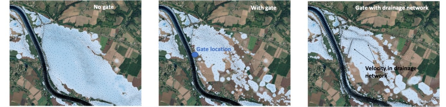

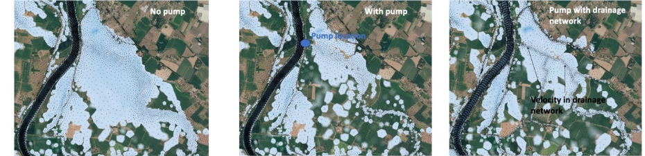
Figure 1: Water depth map around the structures for the three modelling strategies. End time of the flood simulation without data assimilation. The black arrows represent the velocity vectors calculated at each node and show the mesh density.
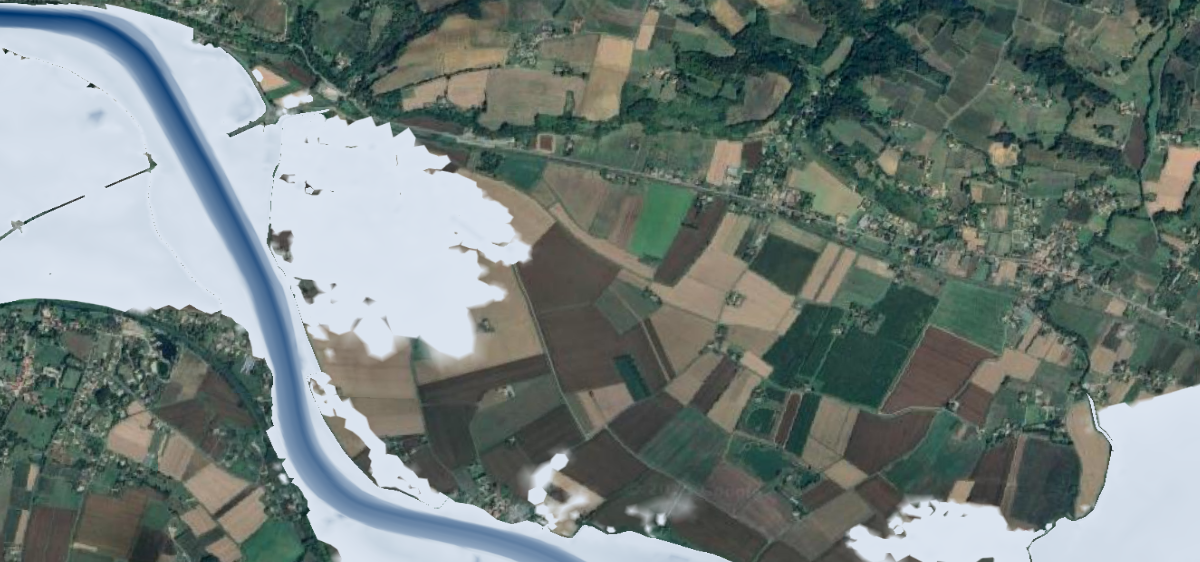
The results show that the structures do indeed reduce the volume of water present in the floodplain. This provides a more realistic representation of water surfaces compared to satellite measurements taken by Sentinel-1.
However, some of the water remains in the model. This is attributed to the fact that natural infiltration is neglected in the model, as well as to the poor representation of the floodplain (mesh resolution is too coarse). Indeed, the drainage network, which is a few meters wide, is not ‘seen’ by the model, even though the DEM is sufficiently detailed to describe it. This leads to a disconnect between the water-covered areas and the structure. We then have basins that remain flooded, even though a ditch would normally connect them to the drainage system leading to the river.
To avoid this issue, a refined mesh in the secondary hydrographic and drainage network has been implemented. We have verified that this results in slightly more areas being drained, but with longer computation times as the number of cells may be doubled. The compromise adopted is to reduce the resolution of the dykes whilst maintaining their hydraulic barrier function. The construction of a mesh structure that achieves the best of these compromises is currently investigated and forms part of the next developments for the structures.
Finally, a last representation error comes from the fact that some sluice gates are operated manually and the management rules are unknown. To address this issue, only the data assimilation of flood extent images can provide a realistic simulation of the receding flood waters.