Basin-Scale Variational Hydrological–Hydraulic Model Calibration for River Discharge Estimation Using SWOT Altimetry
submitted to WRR on 13/01/2026
hydraulics, hydrology, DassFlow 1D, SMASH, variational data assimilation, swot, altimetry, discharge, double regionalization
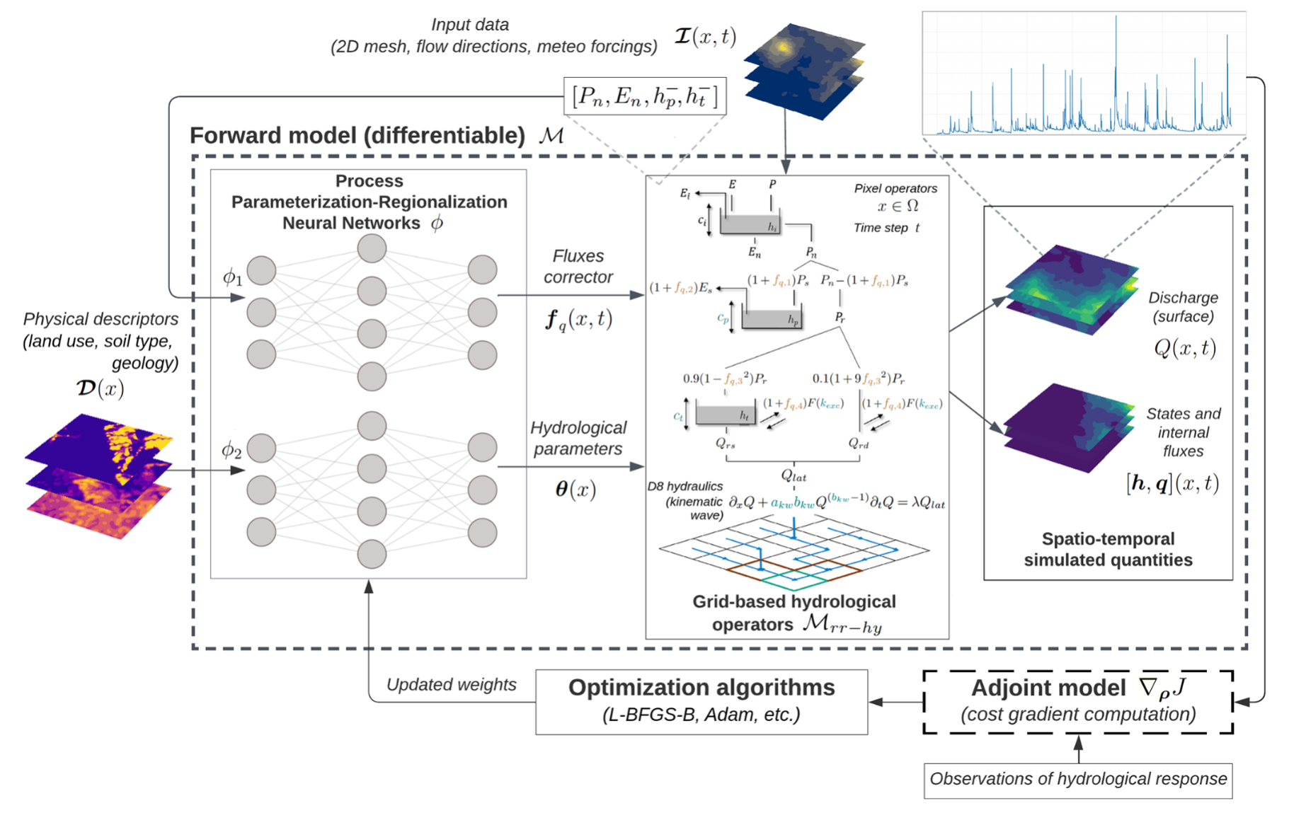
smash v1.0: a differentiable and regionalizable high-resolution hydrological modeling and data assimilation framework
doi.org/10.5194/gmd-18-7003-2025
hydrology, SMASH, differentiable, regionalizable, varaitional data assimilation
A distributed hybrid physics–AI framework for learning corrections of internal hydrological fluxes and enhancing high-resolution regionalized flood modeling
https://doi.org/10.5194/hess-29-3589-2025, 2025
hydrology, SMASH, physics AI, learnable
Assessing SWOT’s Hydraulic Visibility on the Rhine: Precision Flow Lines and Slope-Based Flood Wave Propagation Signatures
https://doi.org/10.1029/2025EA004309
SWOT, hydraulic visibility, validation, Rhine
Learning Regionalization within a Differentiable High-Resolution Hydrological Model using Accurate Spatial Cost Gradients
https://doi.org/10.1029/2024WR037544
hydrology, SMASH, ungauged basins, regionalization, physics-AI, learning
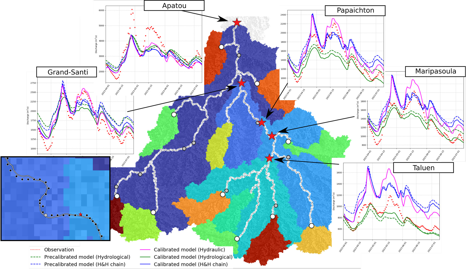
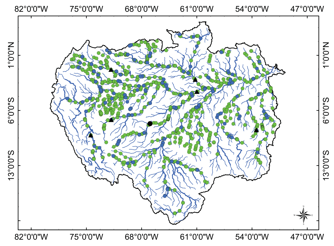
Multi‐Satellite Data Assimilation for Large‐Scale Hydrological‐Hydrodynamic Prediction: Proof of Concept in the Amazon Basin
https://doi.org/10.1029/2024WR037155
Assimilation; MGB; EO datasets; hydrodynamic
Strengthening of the hydrological cycle in the Lake Chad Basin under current climate change
https://doi.org/10.1038/s41598-024-75707-4
Chad lake; climate change
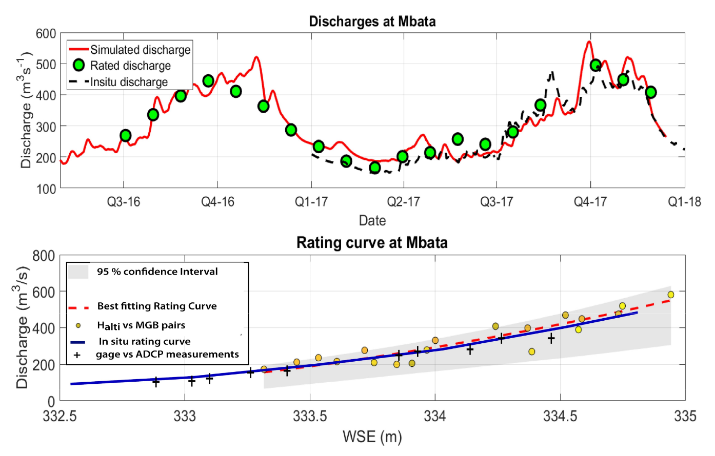
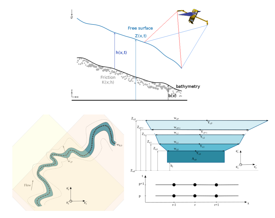
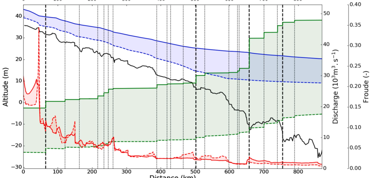
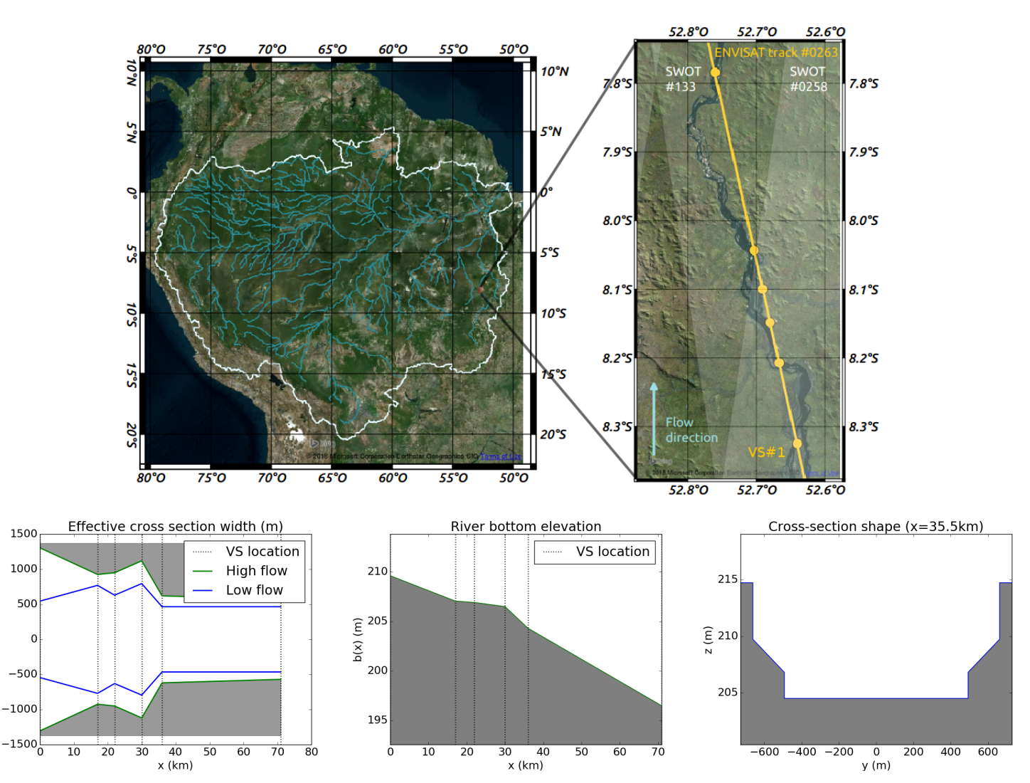
Estimating channel parameters and discharge at river network scale using hydrological-hydraulic models, SWOT and multi-satellite data
Hydrology, Hydraulics, coupling, Maroni, Data Assimilation, Data Fusion, Altimetry, SWOT
Gaussian Anamorphosis for Ensemble Kalman Filter Analysis of SAR-Derived Wet Surface Ratio Observations
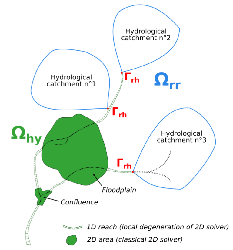
Multi-dimensional hydrological–hydraulic model with variational data assimilation for river networks and floodplains
doi.org/10.5194/gmd-15-6085-2022
hydraulics, DassFlow 2D, GR4H, hydrology, multi-dimensional model, variational data assimilation
ExtractEO, a Pipeline for Disaster Extent Mapping in the Context of Emergency Management
Improvement of Flood Extent Representation with Remote Sensing Data and Data Assimilation
https://doi.org/10.1109/TGRS.2022.3147429
Floodextent, Hydrodynamics, Garonne, Telemac, Data Assimilation, Sentinel1
Dual State-Parameter Assimilation of SAR-Derived Wet Surface Ratio for Improving Fluvial Flood Reanalysis
https://doi.org/10.1029/2022WR033155
Floodextent, Hydrodynamics, Garonne, Telemac, Data Assimilation, Sentinel1
Generation and analysis of stage-fall-discharge laws from coupled hydrological-hydraulic river network model integrating sparse multi-satellite data
River discharge and bathymetry estimation from SWOT altimetry measurements
https://doi.org/10.1080/17415977.2020.1803858
hydraulics, DassFlow 1D, variational data assimilation, discharge algorithm, swot
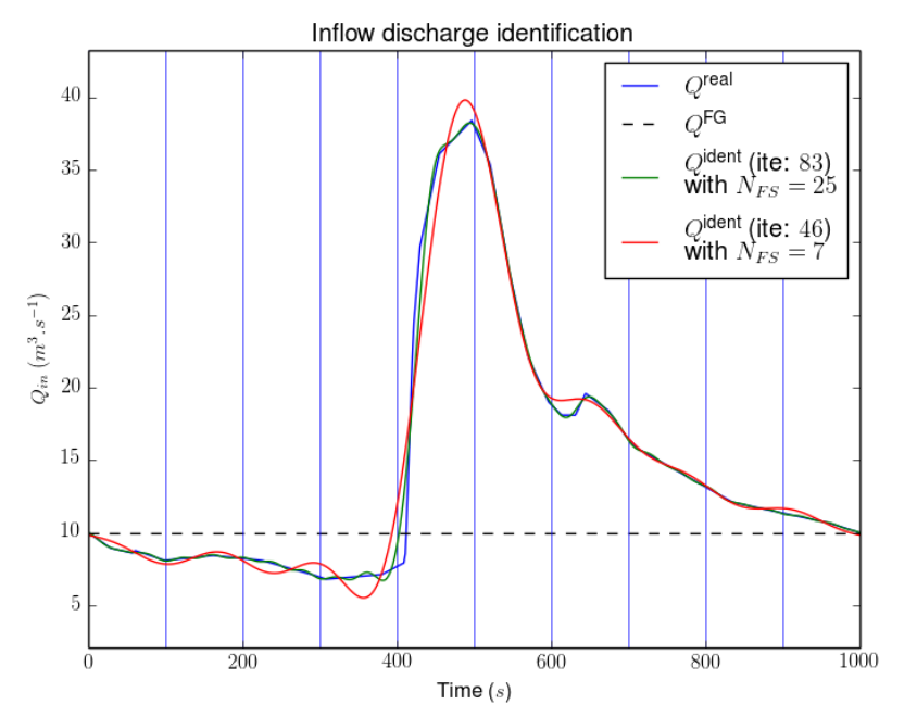
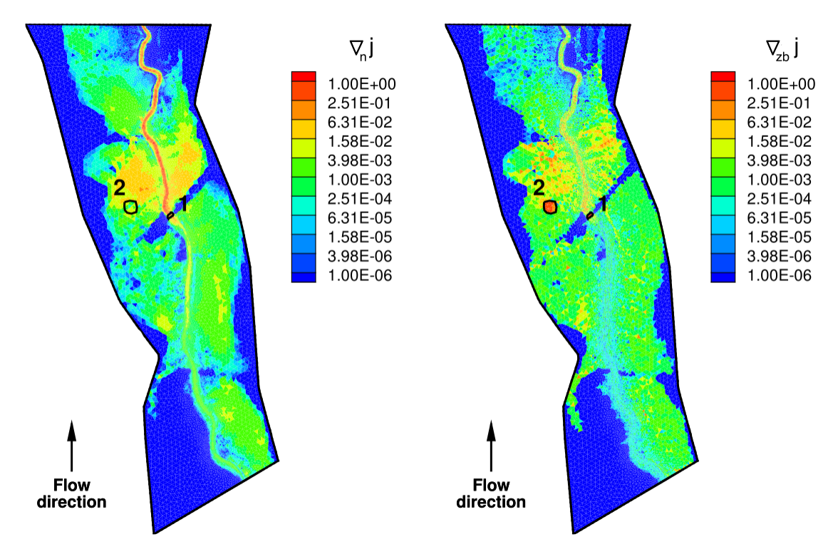
Estimation of multiple inflows and effective channel by assimilation of multi-satellite hydraulic signatures: The ungauged anabranching Negro river
doi.org/10.1016/j.jhydrol.2020.125331
hydraulics, DassFlow 1D, MGB, variational data assimilation, swot, identifiability maps
Variational estimation of effective channel and ungauged anabranching river discharge from multi-satellite water heights of different spatial sparsity
https://doi.org/10.1016/j.jhydrol.2019.124409
hydraulics, DassFlow 1D, variational data assimilation, discharge algorithm, swot, nadir altimetry, imagery
On the Assimilation of Altimetric Data in 1D Saint-Venant River Flow Models
https://doi.org/10.1016/j.advwatres.2018.06.004
hydraulics, DassFlow 1D, variational data assimilation, swot, frequencies, identifiability maps
Modelling hydrologic and hydrodynamic processes in basins with large semi-arid wetlands
https://doi.org/10.1016/j.jhydrol.2018.04.041
modelling; MGB; hydrology; hydrodynamic
Inverse algorithms for 2D shallow water equations in presence of wet dry fronts: Application to flood plain dynamics
https://doi.org/10.1016/j.advwatres.2016.07.005, 2016
Hydraulics, finite volumes, DassFlow 2D, variational data assimilation, flooding, parameters inferrence
Stage-discharge rating curves based on satellite altimetry
and modeled discharge in the Amazon basin
https://doi.org/10.1002/2014WR016618
Hydrology, MGB, altimetry, discharge, rating curves
Monitoring Hydrological Variables from Remote Sensing and Modeling in the Congo River Basin
https://doi.org/10.1002/9781119657002.ch18
https://agupubs.onlinelibrary.wiley.com/doi/abs/10.1002/9781119657002.ch18
modelling; mgb; hydrology; EO datasets; altimetry